Sani –
The first trip up the
Intro:
After we had out trip to Roma we decided that we’d
like to ride the big mountains of
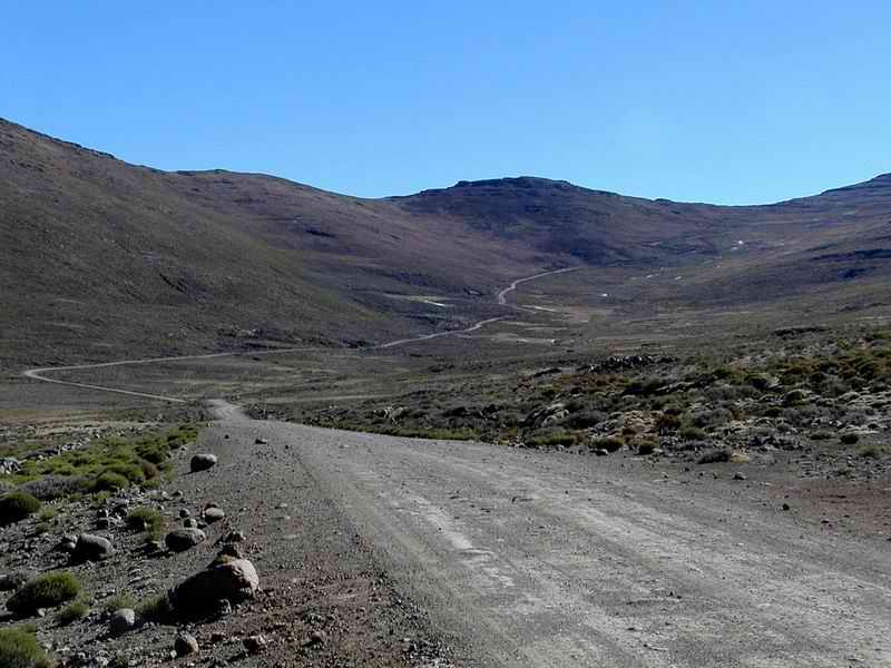
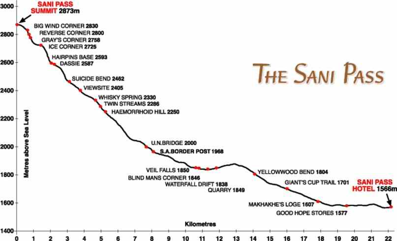
The pass itself is about 9 kilometres long starting
at the SA border control point and ending at the
We wanted to see some snow so I found some cheap
accommodation and we put the street legal kit on the bikes. As the pass is in
fact a public road the vehicles that use it should be street legal.
We drove down early on the Friday morning of the
August long weekend, a trip of about 700 kilometres. We drove from
|
Back Packers lodging |
|||
|
|
|||
|
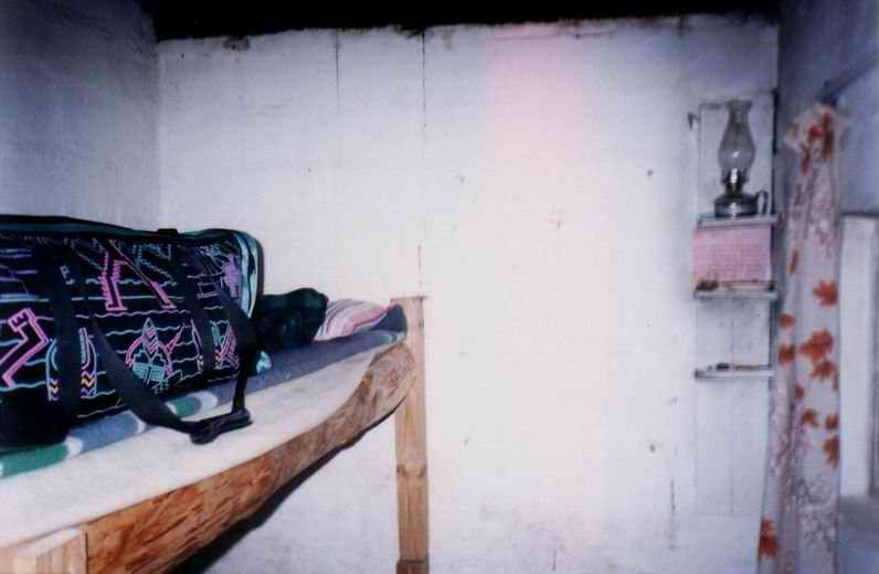
Yes, indeed. I found this place on
the internet and thought at R25.00 (Rands – about 10:1 A toilet. Yes, a converted toilet.
It didn’t smell and the hole had been plugged (that’s about all it had going
for it!) but was just wide enough for us to get in. JR took the top bunk, I
got the bottom one, and fortunately we had sleeping bags. Every time JR
rolled over in the night I got a fine shower of dust sprinkling down on my
face. Lovely… There was a shower of
sorts, it required making a fire under an oil drum so that the water was
heated as it pumped through, but this took forever so we had cold showers. In
August. In the ‘berg. Lovely again… Anyway, we were there to
ride so when we got there at about 11am we kitted up and headed up to the SA
border post. After a bit of persuading the police let us through. Our bikes
were still pretty much in off-road format so it was good of them to do so. NOTE TO ALL PEOPLE GOING
UP THE We were there 4 years in
a row and it seemed there was always some guy with his family in a 4X4
arguing with the Police that they had come all the way and they didn’t know
you needed a passport. Every time the Police turned them around, so be
warned. I don’t know if this is
still the case now in 2006 but it might be worth a call before leaving. A
Commonwealth or South African passport holder didn’t require a Visa. |
|||
|
|
|||
|
Halfway |
|||
|
|
|||
|
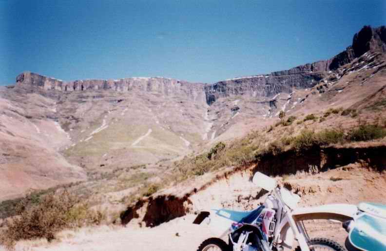
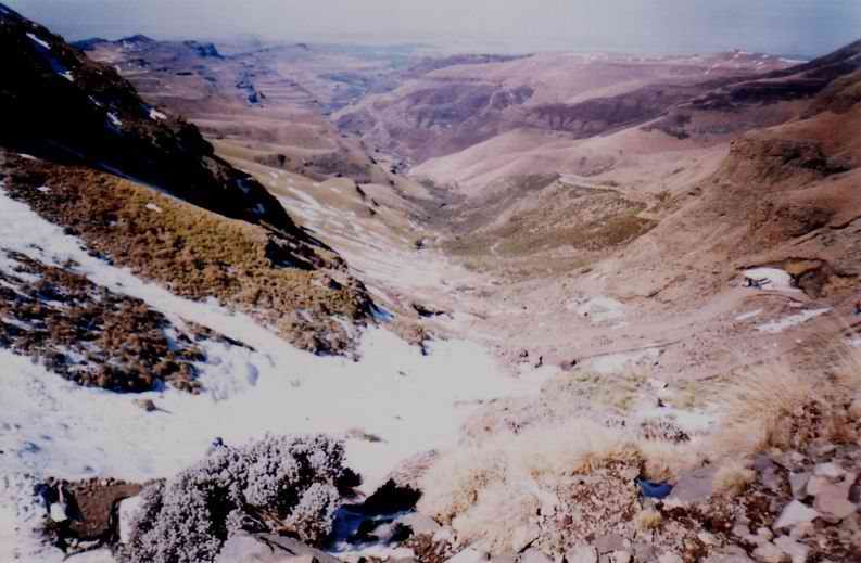
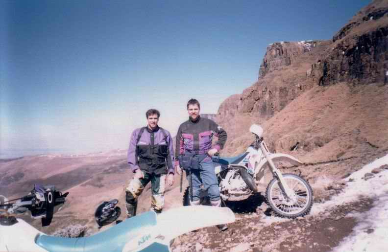
Here we are about half
way up the pass looking south. There’s a little bit of snow left on these
north facing slopes, most had melted off at that point. The bikes were
running ok if a little flat. Altitude must be about 2000 metres. My WR had bigger hand
guards to stop that freezing wind, JR’s KTM was pretty much the same. |
|||
|
|
|||
|
Halfway north |
|||
|
|
|||
|
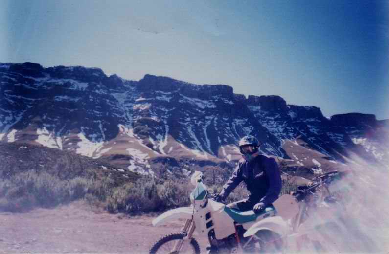
This is the other
direction (North). JR is keeping his helmet on as it’s pretty cold. More snow
on the south facing slopes but not too bad. |
|||
|
|
|||
|
Ice Wall |
|||
|
|
|||
|
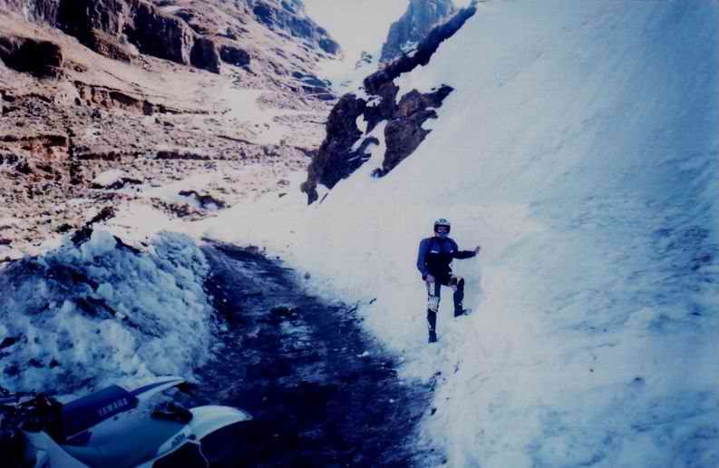
This picture is a little
bit higher up again, JR is standing next to a wall of ice. This had fallen as snow
but during the previous 4 weeks the snow had melted during the day and
re-frozen as ice in the night. This then had built up as a huge chunk of ice
around this bend. A ‘dozer had cut its way through a few days earlier. This picture was
actually taken on the way back down; I had lost the rear coming down the road
here as the surface was pure ice and we didn’t have Trelleborg tyres or
anything for traction. I felt it coming around and there was nothing to do
but let it go. JR was laughing like a hyena as he could see it coming. Not a hard fall though
and the bike was fine. Getting up this section was pretty tricky too; we
found we could sit with our full weight over the rear tyre, let the clutch
out at just above idle and nothing would happen. The rear tyre just turned
slowly. We would push the bikes up one at a time which was pretty hard going.
Altitude and smooth soled (MX) boots did not help. The ice that JR was
standing next to was solid. I thought it might not be snow so I gave it a
solid kick with my steel tipped MX boot. Not a mark, not even a blemish, I
might as well have tried kicking the mountain. |
|||
|
|
|||
|
Looking down |
|||
|
|
|||
|
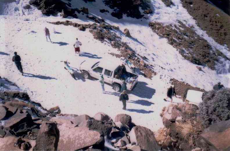
This picture is where we
stopped next a bunch of 4X4’s. This was as far as these guys had got as they
also only had rubber tyres. Nobody had thought to bring snow chains. |
|||
|
|
|||
|
Ice Corner? |
|||
|
|
|||
|
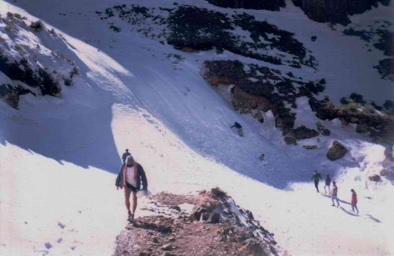
I think this switch back
is called Ice Corner as there’s normally a frozen waterfall here. A lot of these guys were
out of the 4X4’s and had sledges. They were having a great time walking up
and sliding down. It wasn’t really snow at that point but it wasn’t solid ice
either. |
|||
|
|
|||
|
Yamaha and 4X4 |
|||
|
|
|||
|
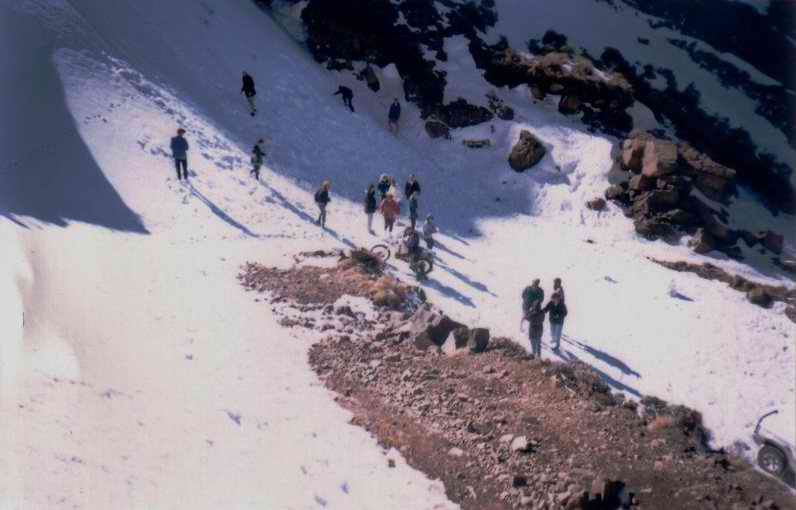
This is picture was
taken from the same place as the one above but looking down over the ‘edge’. The 4X4’s had gotten
this far and wisely decided not to risk ice without chains on a pass with no
guard rails! I parked my WR here so we could look a bit further up the pass
and see if it was worthwhile trying to go any further. |
|||
|
|
|||
|
Push! |
|||
|
|
|||
|
JR, on the other hand,
went at it (he’s like that…). As soon as we got to the
actual corner the ice stopped even the bikes. Here JR is pushing his bike
with the rear wheel just slowly rotating. We found we could let the clutch
out and not even worry about stalling out, there was so little traction! A big thanks to the 8
guys helping… Not. |
|||
|
|
|||
|
Up we go |
|||
|
|
|||
|
This is taken very close
to the same place as the above pictures, we had just managed to get both bikes
around Ice Corner and were taking a quick breather getting ready for the next
switch back. Luckily JR had
reconnoitred this and there was another ‘dozer on its way down so Ice Corner
was the only real problem. To our immediate left there was a mound of snow
and ice (see next picture) that caused some grief but we managed to get
through this eventually. |
|||
|
|
|||
|
Snow and ice |
|||
|
|
|||
|
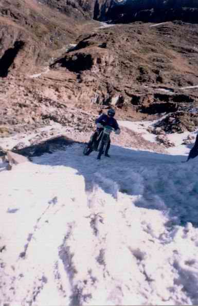
This picture was also
taken on the way down but shows the snow at the point. |
|||
|
|
|||
|
Sani Top |
|||
|
|
|||
|
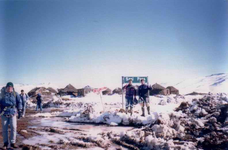
This is both of us at
the top of Sani. After we got onto the
cleared section that the ‘dozer had taken care of it was relatively easy
going to get all the way up. We were the first vehicles to get from SA to The ground here was
churned up really bad. There were a few hikers around and some 4X4’s that
were ice-welded into place outside the Sani Top Chalet. The Sani Top Chalet is
the highest pub in http://www.sanitopchalet.co.za/ |
|||
|
|
|||
|
Snow |
|||
|
|
|||
|
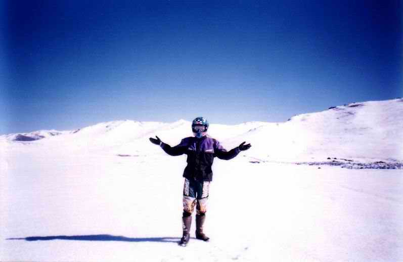
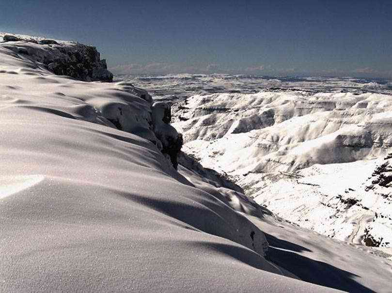
JR on top of the ‘berg. We have moved a bit
inland here and stopped for a couple of pics. As can be seen there is still a
lot of snow up in Behind JR’s left hand is
the road; this had been carved out of the snow and ice. Way back over JR’s
right shoulder the road swings back and up to another, smaller pass called We decided to see how
far in we could get before the snow stopped us. |
|||
|
|
|||
|
|
|||
|
|
|||
|
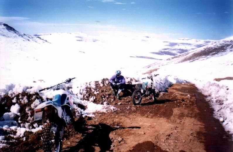
This was quite far up JR took a run at a
switchback up here and lost it. It was my turn to have a laugh! But it was a
big one, I think he was pretty sore afterwards. This was as far as we
got in 1996. The road ahead was covered in snow drifts and it was getting
late. The border is only open from 8:00am to 4:00pm so we had to turn back. |
|||
|
|
|||
|
|
|||
|
|
|||
|
This is the |
|||
|
|
|||
|
Snow of 1996 |
|||
|
|
|||
|
This picture is courtesy
of Sani Top Chalet. It shows the extent of the snow of 1996. I don’t think
this happens too often. This looks like it was taken very close to the Chalet,
the pass and South Africa can be seen to the right of the picture. A Lot of
people were cut off. |
|||
|
|
|||
|
|
|||