Trans America Trail - 2008
Maps.
Before
using these please read the following:
You will not be able to do the TAT using these only!
- These GPX route maps are provided free of charge as an aid only to the TAT
official maps.
- They don’t cover
- More importantly, they do not have the gas stops that the paper maps do.
- Sam Correro owns the rights to the route and
maps, as such he can change this at any time. These GPX route maps are
based on the paper maps I received from Sam in January 2008. If you order
paper maps from Sam they might very well be different!
- I’ve found that the Oregon GPX route maps differ
from Sams paper maps; this may occur in other places too.
Note: use
right-click and ‘Save as…’ (otherwise you’ll just see the XML)
Oklahoma
Complete – KML (Google Earth)
Oklahoma/New
Mexico – Part 1 – GPX
Oklahoma/New
Mexico – Part 2 – GPX
Oklahoma/New
Mexico – Part 1 – KML (Google Earth)
Oklahoma/New
Mexico – Part 2 – KML (Google Earth)
Colorado
Complete – KML (Google Earth)
Colorado –
Part 1 – KML (Google Earth)
Colorado –
Part 2 – KML (Google Earth)
Colorado –
Part 3 – KML (Google Earth)
Colorado –
Part 4 – KML (Google Earth)
Utah Complete – KML
(Google Earth)
Utah – Part 1 – KML
(Google Earth)
Utah – Part 2 – KML
(Google Earth)
Utah – Part 3 – KML
(Google Earth)
Utah – Part 4 – KML
(Google Earth)
Utah – Part 5 – KML
(Google Earth)
Utah – Part 6 – KML
(Google Earth)
Nevada Complete –
KML (Google Earth)
Nevada
– Part 1 – KML (Google Earth)
Nevada
– Part 2 – KML (Google Earth)
Nevada
– Part 3 – KML (Google Earth)
Nevada
– Part 4 – KML (Google Earth)
Oregon Complete –
KML (Google Earth)
Oregon
– Part 1 – KML (Google Earth)
Oregon
– Part 2 – KML (Google Earth)
Oregon
– Part 3 – KML (Google Earth)
Oregon
– Part 4 – KML (Google Earth)
These maps were
made using the following technique:
- A route was created from the paper maps in Google
Earth.
- The route was saved as a KML then converted to a
GPX file.
- The GPX file was loaded into the eTrex using
Garmin software.
- Note: the eTrex Vista Cx has a finite capacity of
10,000 waypoints.
- These are divided up into 20 tracks – no track
can have more than 500 waypoints.
- This is why there are numerous files for each
state.
When loading the
maps truncation can take place if more than 500 waypoints are detected in the
GPX file.
I’ve tried to
make sure that no file has more than 500 waypoints but you may need to change
the file if you seen the truncated message.
This can be done
using a XML editor.
The KML files
can be loaded directly into Google Earth (providing you have it installed!)
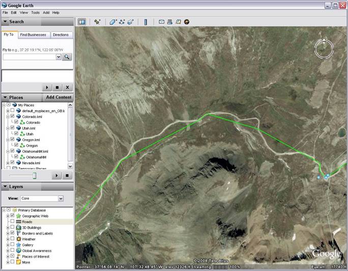
When reading the
viewing the route on the GPS you will notice the route line will not follow the
road directly.
This is because
I’ve had to reduce the number of waypoints to 500. Although this isn’t ideal
it’s not a problem as the route line is a general indication of the direction
and will not follow the road directly. Below is an example: